google-site-verification=eqwDp6v4570NQpwD1V9-OmDXFbTQyWDwwwPvX4BwJdQ

TELEGRAPH TO THE CAPE

Posted On 22 Feb 2024
Comment: Off
This entry is part 18 of 25 in the series AusMotorcyclist Issue#23

FAR NORTH QUEENSLAND WORDS STUART WOODBURY

“Telegraph sang a song about the world outside Telegraph road got so deep and so wide Like a rolling river”. Dire Straits

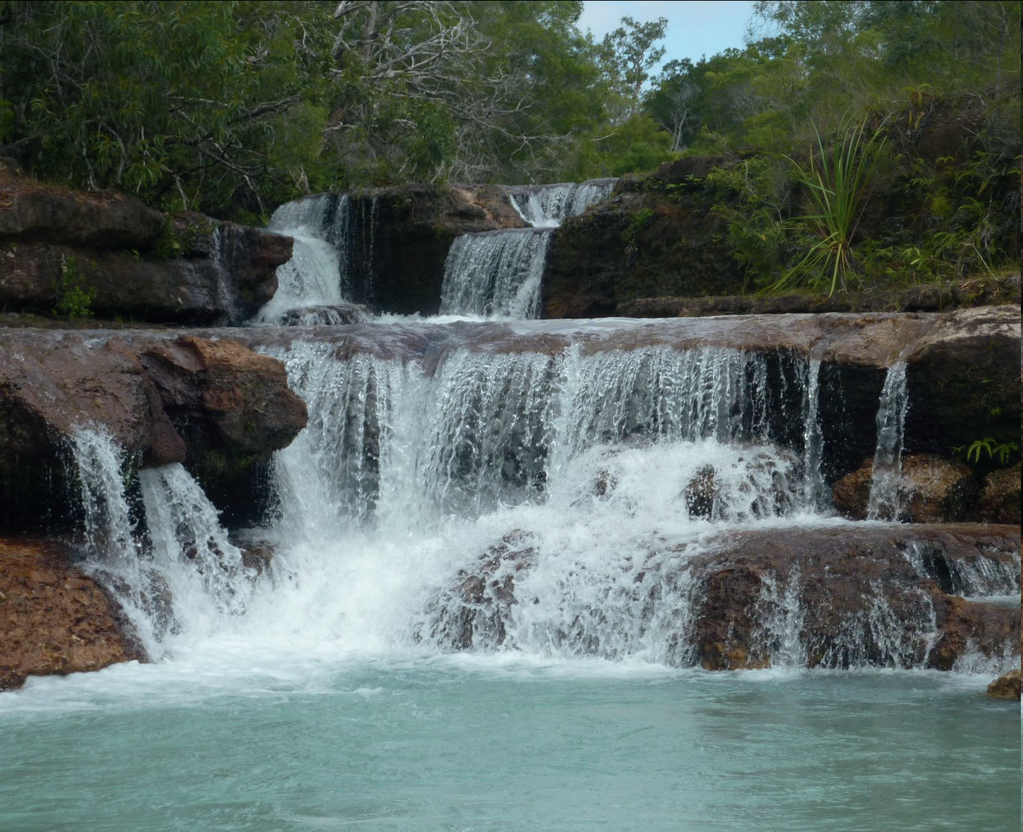
Pack the tent, or pack the swag and let’s go to the Tip on the Telegraph Road.

When you look at this adventure map, it looks pretty easy, as it is marked as a fairly straight line, but don’t let this fool you. There are plenty of technical bits to ride as you get further north from Bramwell Roadhouse. As you will have your tent or swag, take your time and do this trip over two or three days.

COOKTOWN

Cooktown is at the mouth of the Endeavour River, on Cape York Peninsula where James Cook beached his ship, the Endeavour, for repairs in 1770. Both the town and Mount Cook (431 metres) which rises up behind the town were named after James Cook.

It is the northernmost town on the east coast of Australia and was founded on 25 October 1873 as a supply port for the goldfi elds along the Palmer River. It was called ‘Cook’s Town’ until 1 June 1874. Get just about all you want from Cooktown, supplies and plenty of fuel.

COEN

In 1623, Jan Carstensz, the navigator of the ship Pera of the Dutch East India Company named a river on Cape York Peninsula after Jan Pieterszoon Coen, the Governor-General of the Dutch East Indies. Today that river is known as the Archer River and the name Coen River is given to one of its tributaries.

Coen has an airstrip, hotel/motel, guest house, two general stores and fuel outlets, hospital, post offi ce, police station and camping grounds.

Archer River Roadhouse Archer River Roadhouse is open Apr–Dec and closed at other times due to the wet season. The licensed roadhouse offers meals, fuel and basic mechanical repairs. In addition to the camping facilities, 10 single air conditioned rooms and 4 twin rooms are also available on site.

BATAVIA DOWNS

No facilities are available at Batavia Downs, it is only a reference point to take the optional route.

WEIPA

Weipa is the largest town on the Gulf of Carpentaria coast of the Cape York Peninsula in Queensland. Weipa exists because of the enormous bauxite deposits along the coast. The Port of Weipa is mainly involved in exports of bauxite.

Weipa has a Woolworths for supplies and fuel, plus accommodation and an airport.

MAPOON

During the wet season from December to April the area is inaccessible except by air and sea, but when you can get access, the town has a small shop and fuel available.

BRAMWELL ROADHOUSE

A working cattle station, you can check out some livestock, but mainly you would be after accommodation, food and fuel, which is all available.

BAMAGA

The original site for the township of Bamaga was at a site known as “Muttee Heads” some 20 kilometres south of the present Bamaga township. The present site was established after World War 2 by people from Saibai Island in Torres Strait, after Saibai Island was devastated by abnormally high tides.

It is named after Saibai elder, Bamaga Ginau.

A supermarket, accommodation, fuel and basic services are available.

CAPE YORK

Cape York Peninsula is a largely remote area, the largest unspoiled wilderness in northern Australia and one of the last remaining true wilderness areas on Earth. The climate on Cape York Peninsula is tropical and monsoonal (as is most of Far North Queensland), with a heavy monsoon season from November to April, during which time the forest becomes almost uninhabitable, so plan this trip in the months from May to October.

Start out of Cooktown and head west on the Mulligan Hwy over to Lakeland and get onto the Peninsula Development Rd. Head North – North-west up to Coen.

You may wish to stay overnight at Coen or continue on up to Archer River Roadhouse and camp.

About 117km out of Coen, you need to turn right onto the Telegraph Road. Follow this North to Bramwell Junction where you need to fill up and then continue north on the now narrower track.

This is where conditions can get a little tougher, especially once you get to the river crossings, which will also have sand on both sides.

If you want to miss the river crossings, you can take the Bamaga Road and use the Jardine River Ferry (07 4069 1369) and continue up to Bamaga.

North of Bamaga to Cape York is around 40km where you can camp overnight, or return to Bamaga.

DISTANCE

Cooktown to Cape York – Around 820km

Bamaga to Cape York – Around 40km (return 80km)

Batavia Downs to Mapoon – Around 215km (return 430km)

OPTION ROUTE

If you want a side detour along this route, once you get to Batavia Downs, you can turn left and head into Weipa and go up to Mapoon and Red Beach.

A permit is required in this area, so contact Mapoon Shire Council on 07 4090 9124. This route is a 215km each way detour.

FUEL

Calculate your trip well. Fuel stops will be an essential part of the planning for this 820 odd kilometre ride. You also need to bear in mind fuel in many places is only available at certain times throughout the day. The average is 8am – 5pm. Some open earlier and some stay open a little later, but work on this average and you’ll be fine.

Fuel on the way to Coen is available at Hann River Roadhouse, Musgrave Roadhouse and Coen itself.

After Coen, you can get fuel at Archer River Roadhouse, Bramwell Junction, Jardine River Ferry and Bamaga. Some motorcycle tanks may require that you carry fuel, but most mid to big adventure bikes will be fine.

ROAD CONDITIONS

Another essential part of your planning for this trip is the road conditions.

Depending on grading, rain, heat and so on, the road will vary from easy to quite diffi cult. As a general rule, plan this trip during the months of May to October.

For live road conditions, visit www.cook.qld.gov.au/current-road-status or www.tourismcapeyork.com/journey/road-conditions/ To call, phone Traffic and Travel Information Services 131 940 or you can visit their website www.131940.qld.gov.au Roadhouses along the way are a good source of information. Here are the phone numbers of the ones you may wish to call.

Hann River Roadhouse – 07 4060 3242

Musgrave Roadhouse – 07 4060 3229

Archer River Roadhouse – 07 4060 3266

Moreton Telegraph Station – 07 4060 3360

Bramwell Junction – 07 4060 3230

Bamaga Information Centre – 07 4069 3211

FAR NORTH QUEENSLAND
Series Navigation<< READERS’ TRAVEL WHAT DID EMERSON SAY AGAIN?A JACKET THAT DOESN’T LOOK LIKE NORM’S >>
About the Author
Australian Motorcyclist Magazine is Australia's leading motorcycle travel magazine.
Page Scroller Supported By Bottom to Top